Drawing and Modeling Urban Spaces with AutoCAD and SketchUp
Course final project
A course by Bruno Arancibia , Architect

Joined April 2021
About the final project for: Drawing and Modeling Urban Spaces with AutoCAD and SketchUp
Drawing and modeling of urban environments with autocad and skecthUp
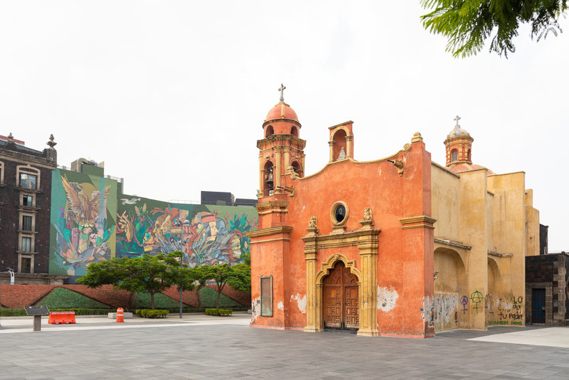
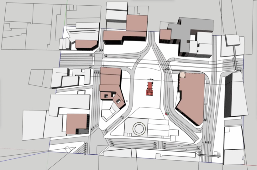
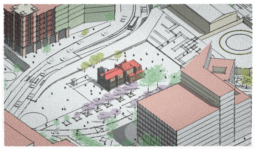
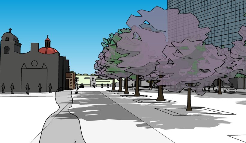
“You have reached the end of the course, and now it is your turn to do your own project and practice everything you have learned. For your final project you will have to model an urban environment using AutoCAD and SketchUp. I share an example of what are the steps that I would like to see in your process: The site: Identify and locate the urban site that you are going to document. I recommend using Google Earth, Google StreetView, and search engines to research the site and collect photographs, street-level views, and a satellite photograph of the site you are documenting. Also search and download urban or cadastre plans that include the site.

Partial transcription of the video
“We have reached the end of the course. But before we say goodbye. let's review what you've learned so you apply it effectively to your own project. From identifying the urban site and planning the design to rendering and exporting the final scenes. each step is crucial for success. final stages of the 3D model. First. you need to identify and locate the urban site you will document. Afterward. utilize Google Earth and Google Street View along with various search engines to thoroughly investigate the site. Gather as many photographs. detailed street-level images. and a precise satellite of t...”
This transcript is automatically generated, so it may contain mistakes.
Course summary for: Drawing and Modeling Urban Spaces with AutoCAD and SketchUp
-
Category
3D & Animation, Architecture & Spaces -
Software
AutoCAD, SketchUp v21 -
Areas
3D Modeling, Architectural Illustration, Architecture, ArchVIZ, Digital Architecture, Landscape Architecture

Bruno Arancibia
A course by Bruno Arancibia
Bruno Arancibia graduated with a degree in architecture from the National Autonomous University of Mexico (UNAM) and then studied abroad at the École Nationale Supérieure d'Architecture de Paris-Belleville (Ensa-PB) in Paris. He currently works for OTC, a Hong Kong-based consultancy specialized in planning for intermodal transportation terminals.
Throughout his career he has also worked independently and collaborated on different urban, architectural, interior, and furniture design projects. He loves analyzing and understanding cities and views each of their complex urban environments as pieces to a puzzle for architects and urban designers.
- 100% positive reviews (59)
- 3,363 students
- 15 lessons (2h 45m)
- 19 additional resources (9 files)
- Online and at your own pace
- Available on the app
- Audio: Spanish, English, French, Italian, Portuguese, Turkish
- Spanish · English · Portuguese · German · French · Italian · Polish · Dutch · Turkish · Romanian · Indonesian
- Level: Beginner
- Unlimited access forever
Recommended software & tools for this course
Category
Areas